This Te Wiki o Te Reo Māori (Māori Language Week), we wanted to shine a spotlight on the settlement of Tuahiwi and its significance to our District and to Māori culture.
This is an extract from the September 2024 e-Newsletter
With a population of just over 1000, Tuahiwi is a rural settlement nestled between Woodend and Rangiora. It is the home of Ngāi Tūāhuriri Rūnanga and has played a significant role in the history of Ngāi Tahu, Waimakariri, and Te Waipounamu.
Tuahiwi, means beyond the mound, and takes its name from the ridge that runs from the Kaiapoi township through to Rangiora.
Kaiapoi Pā
Nearby, the famous Kaiapoi Pā was established by the first Ngāi Tahu ancestors when they settled Te Waipounamu (South Island) and was a major centre of trade and nobility for Ngāi Tahu. Built around 1700, the pā was the largest and most important of Ngāi Tahu strongholds. Its memorial site is situated on the outskirts of Pegasus.
Tuahiwi was one of a couple of smaller settlements that co-existed alongside Kaiapoi Pā. When the pā was destroyed by a war party led by Te Rauparaha, chief of the Ngāti Toa iwi, Tuahiwi was also attacked. The eventual destruction of Kaiapoi Pā in 1832 rendered the entire area unsafe and the Ngāi Tūāhuriri people fled to the safety of other Ngāi Tahu settlements elsewhere in Te Waipounamu.
Tuahiwi remained deserted until many Ngāi Tahu whānau started returning in the 1840s.
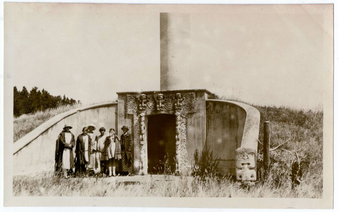
The Kaiapoi monument on the pā site, circa 1900s. Christchurch City Libraries collection (contributor: Alison Wilson).
Kemps Deed and Māori Reserve 873
In 1848, Māori reserve lands were granted to Ngāi Tūāhuriri whānau because of the Crown’s Kemps Deed purchase of rights to most, but not all, of the natural resources of the South Island. The purpose of Māori Reserve 873 (MR 873) was for mana whenua to establish and retain a ‘kainga nohoanga’ (place of residence) for Ngāi Tūāhuriri.
However, in 1862, new planning rules restricted descendants’ use of the land set aside under Kemps Deed and much of the Reserve was alienated through the acts and omissions of government agencies over more than 150 years.
In 2011, Waimakariri District Council requested the Manager of Planning and Regulation to amend the District Plan to recognise the rights and duties arising from Kemps Deed.
At the time, Mayor David Ayers said, “This is an important issue for the District and a very important one for those in the reserve. This is about the right of people to settle on their own land and this is an important step in this way forward. It has been ongoing since 1860 and there have been numerous attempts through the 19th and 20th centuries to resolve these issues.”
Consultation was extensive and involved Ngāi Tūāhuriri Rūnanga, Mana-Waitaha Charitable Trust, as well as the wider community and private landowners in MR 873.
On 21 April 2015 a report went to Council seeking changes be made to the District Plan which would allow more flexibility for development of/provision for kāinga nohoanga in line with the intentions of the Kemps Deed. The report was approved and changes were made to the District Plan which updated rules for the development of land in MR 873.
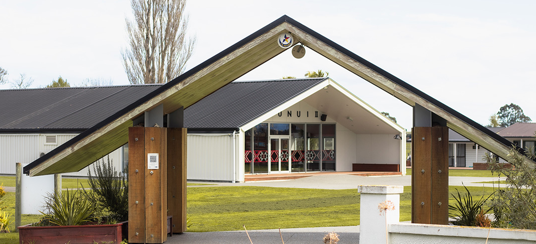
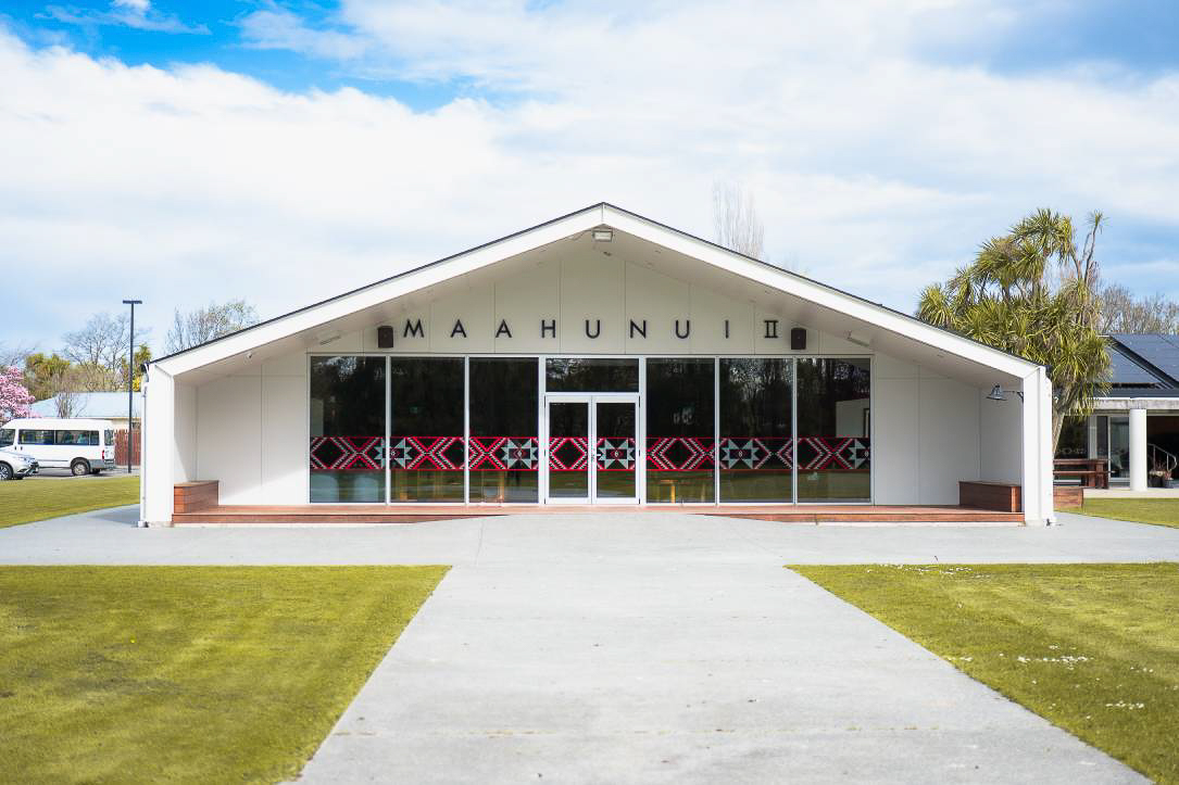
Tuahiwi Marae
Tuahiwi Marae has long provided a focus for not only Ngāi Tūāhuriri and the local community, but for the whole of Ngāi Tahu.
Tuahiwi’s proximity to the sea is recognised in the name of the wharenui, Maahunui II. The wharenui is called Maahunui II after the waka of Maui from which he ‘fished up’ Te Ika a Maui, the North Island. The wharenui does not embrace a specific whakapapa but represents and embodies all Ngāi Tahu whānau – all Ngāi Tahu will fit in the canoe of Maui.
Stay informed, stay involved. |
|---|