A new eastern arterial in Rangiora has been in planning since 2001 and is getting closer to fruition. This page provides information, updates and background about the project.
The planned new arterial road will follow the designation in the Proposed District Plan. From the North, starting from Spark Lane it will traverse through farmland and council-owned land to Boys Rd and on to Marsh Rd to the west of the wastewater ponds, before connecting with Lineside Rd via a new dual lane roundabout. A new railway crossing will connect back into Southbrook from the roundabout.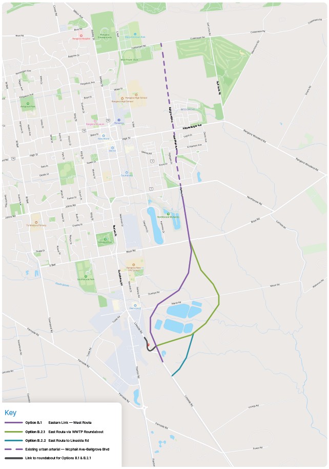
Why does Rangiora need a new eastern arterial?
There are three main problems that a new arterial can help address:
- The rapid growth of residential population and business activity in Rangiora over the last twenty years has increased traffic volumes, leading to severe congestion on Southbrook Road, causing very slow travel times into and out of the township for both freight and people.
- Three to five thousand new homes are planned for East Rangiora and these new residents will need good transport links to Southbrook and onto Christchurch, otherwise it will further increase congestion and divert drivers onto less suitable routes.
- The increasing traffic volumes along Southbrook and Lineside Road is increasing the risk of accidents on the level railway crossing as well as for pedestrians crossing Southbrook Road to get to school, church, the supermarket and other key social destinations.
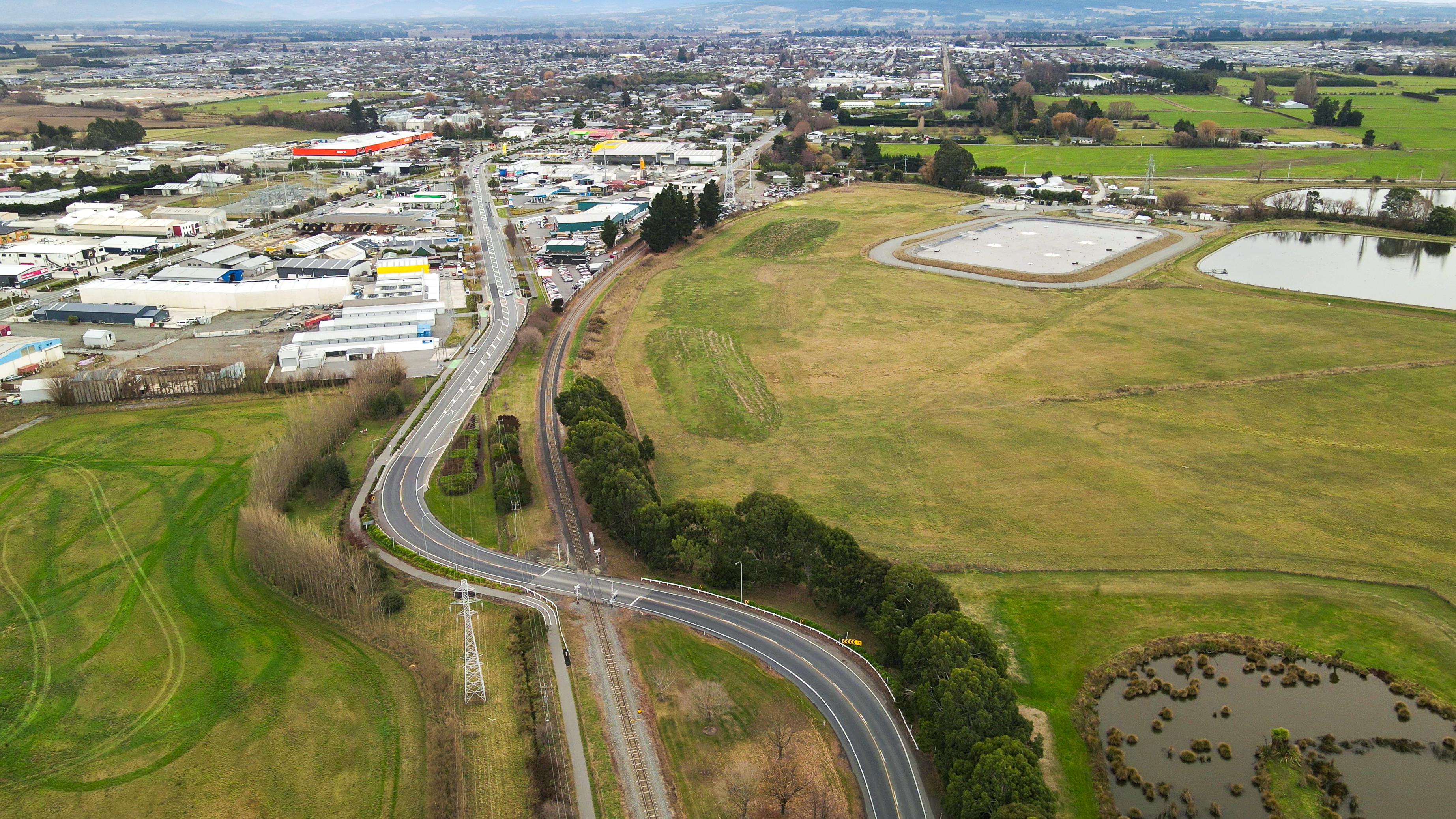
Image taken from the Lineside Road entrance to Rangiora looking North.
What sort of the road are we talking about?
The road will be two lanes (one each way) and 60km/h where there are no houses along the side of the road. This will reduce to 50km/h where there are driveways connecting onto the road.
There will be a shared use path (combined cycleway and walkway) alongside the road.
There will be a new roundabout and level rail crossing near where the existing rail crossing is on Lineside Road.
What is the route?
The plan aboive shows the route of the new arterial. This is the same as the designation in the Proposed District Plan and has been shown in a range of planning documents (such as the East Woodend Structure Plan) since it was originally thought about in 2001.
The route connects to McPhail Avenue. This road was built quite wide in anticipation of the eastern link being constructed. The route continues north into Bellgrove Boulevard which will eventually connect with Coldstream Road, providing a new north-south arterial route from the north to the south of Rangiora.
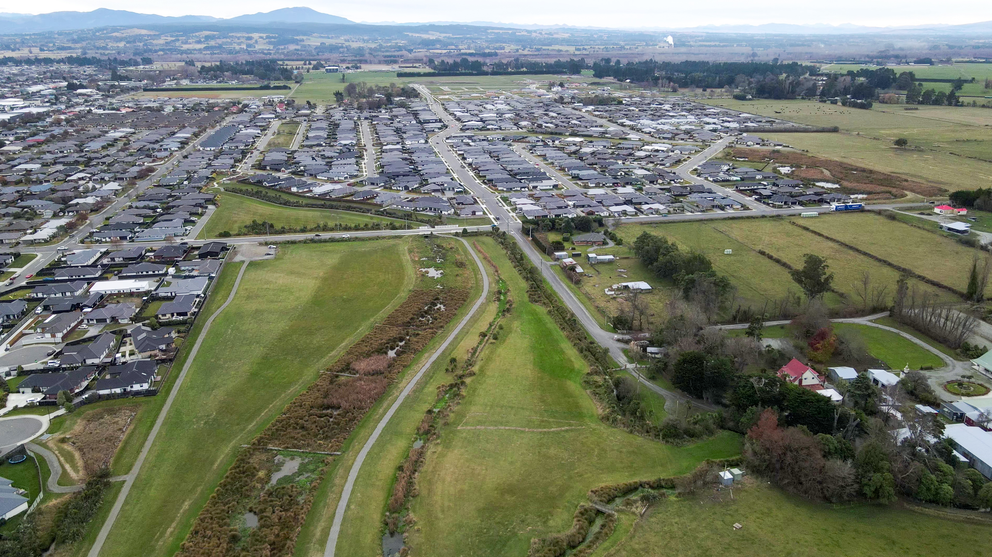 Image taken looking North from the Northbrook Wetlands. Sparks Lane is in the foreground on the right.
What is the cost and timeframe.
The cost of the project is estimated to be $35 million, This is an initial cost estimate only and work is underway to prepare a concept design and more detailed cost estimate. We expect to have a more accurate forecast of the cost in late 2025.
The Council’s Long Term Plan currently shows the project being delivered in 2028 and 2029. This is subject to receiving funding from the Government's National Land Transport Programme, which may mean the work is brought forward or delayed depending on funding availability.
The planning work and concept design is being funded between the Council (using rates) and New Zealand Transport Agency (NZTA). It is expected that the construction cost will be funded through a combination of development contributions, rates and money from the Government (through NZTA).
What work has been done so far?
- The Rangiora Transport Study (2001) identified the need to relieve congestion and service growth areas in the future and proposed the Rangiora Eastern Link and other interventions as a package of measures.
- A Scheme Assessment Report (2005) advanced investigations of a route for the proposed Rangiora Eastern Link.
- Preparation of the Notice of Requirement (2021) for the Proposed Waimakariri District Plan to establish a Designation for the land required.
- A range of Technical Studies have been completed to address potential areas of risk and environmental impact to support the Notice of Requirement.
- Intersection modelling (2024) has been completed to assess options for the design of the intersection at Lineside Road and new level railway crossing.
- A Transport Assessment to support selection of the options for the route and confirm the effectiveness of the arterial in addressing congestion
- The Council considered the options for the route of the arterial on 1 April 2025.
You can find publicly available reports on the Related Links section of this page.
Contact information
Name: Rob Kerr
Phone: 0800 965 468
Email: rob.kerr@wmk.govt.nz